Showing posts with label I-91. Show all posts
Showing posts with label I-91. Show all posts
Thursday, January 19, 2012


Thursday, August 04, 2011
Sheffield Wind Turbines
I-91 Southbound between Exits 25 and 24

After years of legal fighting, the windmills are going up on Hardscrabble Mountain in Sheffield. These are the first photographs that I took on July 7, 2011. There are about 8 turbines up now, and as I proceed through my photograph editing, you will be able to follow the construction as it proceeds. There will be a total of 16 turbines installed when this construction is over.

After years of protests, I am now accepting the towers. They are beautiful in a way. I still mourn the loss of two hundred acres of habitat and I still am concerned about birds and bats (what are left of them). But moaning now won't change a thing, so I'm going to sit back and enjoy photographing them. I hope to visit the site in the future.


_/\_/\_
Saturday, June 12, 2010
Scott Wheeler: Giving a Voice to Vermonters in Montpelier » Sad Story From Barton
Scott Wheeler: Giving a Voice to Vermonters in Montpelier » Sad Story From Barton
I'm friends with the family who is suffering this awful loss and the entire town of Barton — indeed, the entire Northeast Kingdom — is shocked and sad. Please help my church help the family. The moose collision took place at Sheffield Heights on I-91, the infamous section of the road where the weather is horrid and the moose are many. I constantly worry about my family when they travel that road.
I'm friends with the family who is suffering this awful loss and the entire town of Barton — indeed, the entire Northeast Kingdom — is shocked and sad. Please help my church help the family. The moose collision took place at Sheffield Heights on I-91, the infamous section of the road where the weather is horrid and the moose are many. I constantly worry about my family when they travel that road.
_/\_/\_
Sad Story From Barton
swheeler at 5:47 am on Saturday, June 12, 2010
Although outside of my district, I can’t help but feel for the family of a young woman who was killed when her car hit a moose. She leaves behind three children from nine years to six months. I can not imagine their pain. If anybody wishes to donate to a fund for the family they can mail it to the “Larose Fund” to the Barton United Church, PO Box 306, Barton, Vermont 05822. Hopefully the Save the Pete people will now refocus their lives from a moose (who, no, contrary to some people, is not a human, does not talk, and isn’t running for governor) onto this suffering family. My heart goes out to them.
Thursday, March 25, 2010
From Sheffield Heights to New Hampshire
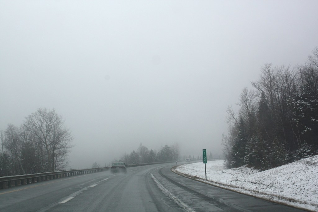
 Somewhere at the top of Sheffield Heights (the highest point on I-91), traveling south.
The Heights has notoriously bad weather winter or summer. It was snowing everywhere north of this point.
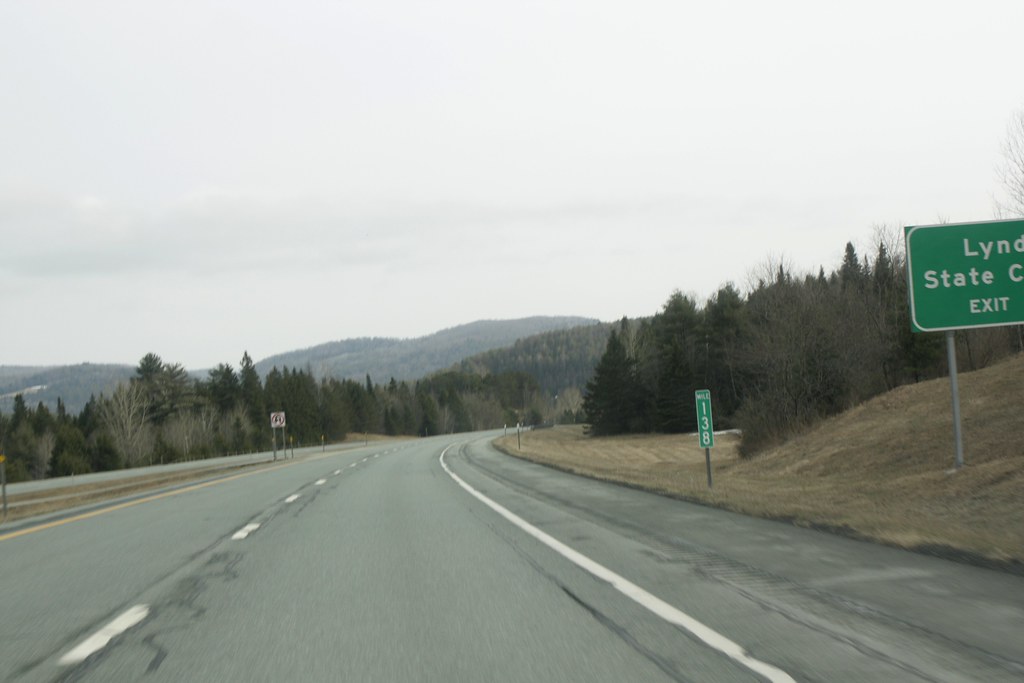 Approaching Lyndonville at mile 134 traveling south. Barton is north somewhere around mile 155. The snow is gone and the clouds are higher. Wikipedia has a great article about the mile markers and exits on the entire route of I-91 from New Haven to Canada.
 Further south, it is dryer.
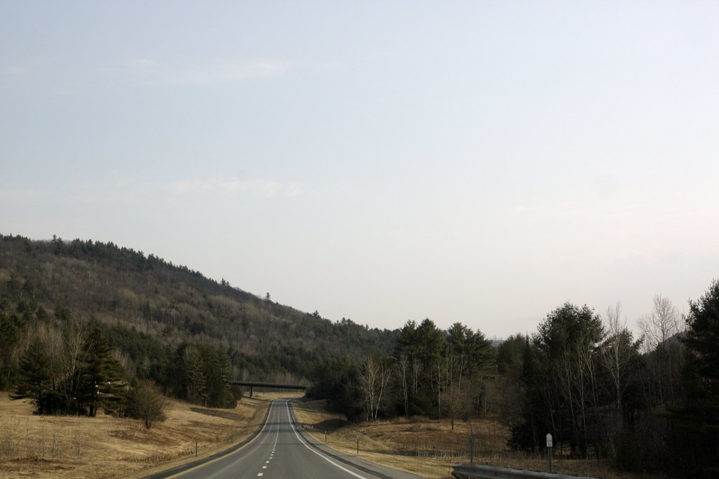 Somewhere after Barnet the road looks even better.
 I love ribbon of highway winding around the mountains in Vermont.
 Finally back on Route 11 in central New Hampshire, the sun was nearly out, and setting. The tiny bit of mountain here is Ragged Mountain.
Technorati Tags: I=91 Vermont Del.icio.us Tags: I=91 Vermont Flickr Tags: I=91 Vermont

_/\_/\_
Wednesday, March 24, 2010

Monday, November 30, 2009
OK So One More Pointless Video
We went to Barton for a visit on Columbus Day weekend (October 10th weekend). This is also the peak color weekend here and the leaf peepers were clogging the highways in New Hampshire. Fortunately, the roads were clear in northern Vermont. But I was tense enough to take one more pointless video.
If you click on the links below, you will be taken to the video on youtube.com, where you can again click the time of the video and then see only that section of the video:
0:00-0:31 I-89 North from New London, NH to rest stop
0:32-0:54 I-89 North Rest stop before Lebanon. Leaf peepers.
0:55 - 1:10 I-91 North in Vermont just north of White River. Red sumac
1:11- 2:45 I-91 North Comerford Dam on Connecticut River, Barnet, VT.
2:46 - 7:23 I-91 North Sheffield Heights, Wheeler/Glover/Barton Vermont in the Northeast Kingdom. Highest elevation on I-91 (nearly 2,000 ft or 610 m). The furthest mountains are in Canada.
4:13 Barton Mountain. The triple hump: tall on right, medium in the middle and small on the left. My house is 800 feet below the medium hump, halfway up.
4:51 on our way downhill from the Heights to Barton Village at 900 feet. You drop 1,000 feet on the highway in a short time. Gets rough in the winter.
7:24 to the end: the road to my Vermont house. The neighbors, the mountain, the horses.
0:32-0:54 I-89 North Rest stop before Lebanon. Leaf peepers.
0:55 - 1:10 I-91 North in Vermont just north of White River. Red sumac
1:11- 2:45 I-91 North Comerford Dam on Connecticut River, Barnet, VT.
2:46 - 7:23 I-91 North Sheffield Heights, Wheeler/Glover/Barton Vermont in the Northeast Kingdom. Highest elevation on I-91 (nearly 2,000 ft or 610 m). The furthest mountains are in Canada.
4:13 Barton Mountain. The triple hump: tall on right, medium in the middle and small on the left. My house is 800 feet below the medium hump, halfway up.
4:51 on our way downhill from the Heights to Barton Village at 900 feet. You drop 1,000 feet on the highway in a short time. Gets rough in the winter.
7:24 to the end: the road to my Vermont house. The neighbors, the mountain, the horses.
_/\_/\_
Saturday, October 31, 2009
Driving to Connecticut
I have an irrational fear of being a passenger while driving through heavy traffic. When we went to Old Saybrook in September, John drove the truck. To keep myself busy and calm, I began to record the heavy southern New England traffic. It worked. I didn't shriek out as often. None of you will be interested in watching this long, pointless video. But it has lots of memories in it for me. Watching this, for me, is identical to riding a hellish roller coaster (which I will never do). I get the same dropping feeling in the pit of my stomach.
If you click on the times below, you will be taken to a new window in youtube. Then, click "more" on the right hand description of the video, then click the time section again that you want to see. After the video loads, you can watch just that section that you clicked.
0:00 - 1:30 The video begins in Wallingford, which is just north of New Haven. The truck windows have never been cleaned. See how close the trucks are? How fast people drive down there?
1:31- 3:33 Traffic comes to a scary, screeching halt just outside of New Haven. It's always like this. For miles. Until i-95 which takes you to New York City. Which is why it's always awful.
3:34 - 3:46 We move to the right lanes to get off of this insanity. We can use GPS to go through the city streets of New Haven to get to Anna's house.
3:47- 6:08 We exit at the police station and train station. The train station is old and pretty. The police station looks like a fortress. Traffic is just as awful but at least it isn't as dangerous. The bridges in New Haven are unique. To me. We have to cross one of them in order to get to Anna's place on Long Island Sound.
5:30 a man gets out of a car next to us because it's quicker to walk to the train station than to drive.
6:09 - 7:35 We leave Anna's place after picking up a desk that she has for Amy. We now get onto i-95 North (towards Providence) to get to Old Saybrook from New Haven. You can see New Haven Harbor and the oil tank farm at 6:10. I counted a dozen construction cranes building stuff. Somebody's economy is doing good. The road is more narrow but traffic is better. It's easier to drive the further you get from NYC.
7:35 - end We are in Old Saybrook on the road that the weekend house is on. The road is on the Sound which you can see a bit of. Then we get to the house and I tape that.
_/\_/\_
Thursday, October 18, 2007
New Haven

I spent the entire day from noon to 6 PM driving to New Haven, Connecticut — approximately 275 miles south — in order to visit Anna and Aaron during our long Teacher Convention weekend. It was awful from Massachusetts on. The rudeness, hostility, paranoia and anger everywhere emphasizes the tolerance and peace of Vermont. The filth, noise and pollution are also huge. I stopped in Wallingford, Connecticut to get a Coke and found the pay phone which I photographed and posted above.
I saw several animals that had been killed by cars on the highway: two skunks, a deer, a dog, a raccoon, a cat. But the saddest sight was when I drove by a coyote that had been killed and was lying on the shoulder of the highway. It's mate was sniffing the body and walking in circles around the dead coyote. It broke my heart.
_/\_/\_
Friday, June 15, 2007
Half Way To The North Pole
 Sign on I-91 North, up the road in Derby Line, which is a bit north of me.
 My latitude is 44° 45' 46.5" North. That is only 14 min 13.5 sec south of the 45th parallel. One minute is (very roughly) one mile, so I am about 15 miles south of halfway to the North Pole. I will have more details about my location when I get my hands on a friend's GPS toy. Neat stuff.
_/\_/\_
Thursday, June 14, 2007
Welcome to Vermont

I-91 south, a few yards south of Canadian border in Derby Line
I would prefer to have been able to get a straight-on shot but they placed this sign at a very inconvenient spot. Eventually I will get the right shot. This will have to do for now. It is satisfying my compulsion for signs.
_/\_/\_
Sunday, April 08, 2007
Easter In The Kingdom

Photos: I-91 Northbound, Sheffield Heights (Sheffield), Vermont, 4.7.07, 4PM
The best thing to be said about April snow is that the roads usually remain clear. That's good because it is still snowing today.
_/\_/\_
Sunday, March 04, 2007
The Beauty of Engineering
 I-91 is a beautiful road. At least in Vermont. There are sections in Massachusetts that are lovely but not like here. In Connecticut, I-91 is just ugly. When I stopped today at the Commerford Dam scenic turnout in Barnet, VT I took these photos. The road cut is very impressive here.
Below, you can see I-91 North to the left of the merging land from the scenic turnout.
 Below: I-91 South is on the upper ledge. The car here is on I-91 North.
 Someone traveling north:
Coaching Days and Road Engineers
Roads in Britain and the United States during the Canal Age
Roads in Britain and the United States during the Canal Age
Georgette Heyer gave fascinating vignettes of the days of stagecoaches, inns and road agents in her Regency novels. The Regency was the height of the Coaching Era, which extended only from about 1760 to 1840 (exactly contemporary with the Canal Age), from the accession of George III to the accession of Victoria, at the most generous assessment. In 1760 roads were poor, seasonally impassable, carrying mainly local traffic on the feet of men and animals. Land carriage of goods was by pack animal trains, negotiating narrow stony causeways. Only goods of high value could bear the cost of transport, and every inland town relied on the resources of its vicinity. Coaches were a luxury of London and the larger towns. The better-off travelled overland on horseback, even royalty, slowly with their own horses, or more rapidly with post horses. The majority simply walked. 1760 also marked the beginning of artificial navigations, and the rise of canals accompanied the Coaching Era. Before then, if firewood had been exhausted near a town, some of the poor froze to death every winter. Canals soon brought cheap coal. The Oxford Canal, as an example, piled several bargeloads at their Oxford wharf at the beginning of the season that was available to the indigent without charge. This time also marked the painful change from household manufacture of textiles to factory manufacture. The woollen industry, for example, was moved from the Cotswolds and Devon to Yorkshire. Disaster for the spinner and weaver meant good and warm clothes for the masses, previously clothed in coarse rags, and clean, remunerative work for miserable agricultural labourers, as well as the more remarked wealth to the capitalist.
The conditions of the roads and the nature of land transport to 1850 is excellently described in W. T. Jackman's The Development of Transportation in Modern England (Cambridge: C.U.P., 1916), which should be consulted by anyone interested in the subject. This is an economic, not a technical, history, but it gives a very good picture drawn from primary sources. From 1555 to 1835, roads in England were maintained by the system of parish statute labour. On the surface, the law was rigorous. Each landowner had to provide teams and labourers in proportion to the value of his holdings for the maintenance of parish roads under the supervision of a parish surveyor appointed to a term of one year. Those without land could satisfy the requirement by their personal labour for six days a year. However, efforts to enforce the letter of the law were largely unavailing, since no one wished to antagonise his neighbours when his turn as surveyor descended on him, and no one demanded vigour from the surveyor when he would have to occupy the post later. The landless labourer usually observed the six annual days as a kind of holiday from his regular employment. Therefore, the state of the roads depended very much on the whim of the parish, and the necessities of local travel. When long-distance roads crossed barren country with poor parishes, the roads virtually disappeared.
The turnpike system was a means of supplementing parish resources by charging tolls for use of the road. This innovation was by no means welcomed by the population. A parliamentary Act was required to establish a board of trustees for the stretch of road to be turnpiked, the powers of the trustees, the tolls to be charged, and powers to enforce the charges. The Act was for a fixed term, after which the powers would lapse. Erection of toll gates was sometimes the cause of a riot that destroyed and burned the toll booth and resulted in general public disorder. The trustees were local dignitaries, who paid themselves for their efforts from the proceeds of the tolls, and often provided the materials for road maintenance, as trustees buying it from themselves as suppliers at an agreeable price. Usually the tolls were farmed, that is, a person paid a lump sum to the trustees for the privilege of collecting the tolls for a certain period. This privilege was usually auctioned off annually at the local inn. Turnpike trusts could acquire debt if necessary, and many did so. After 1830, many were insolvent. It was generally somewhat easier to bring a turnpike trust to court for nonfeasance than it was a parish. Turnpike trusts were responsible only for short sections, so a long-distance road was likely to alternate good and bad stretches.
The first turnpike Act was in 1663, to improve sections of the Great North Road in Hertfordshire, Cambridgeshire, and Huntingdonshire. The next was not until 1695, for portions of the London to Colchester road. The progress of turnpikes was very slow until after 1760. The very first stage coaches began around 1640, but on the bad roads were slow and infrequent. The Oxford Fly ran summers from 1669, making the journey in a day. The normal journey took two days, spending the night perhaps in Aylesbury. By foot, it was a three-day trip, showing that walking was a reasonable alternative.
The post had always existed, at least for official messengers and messages. Postmasters were appointed at all important towns, who supplied accommodation and horses for royal messengers. They also kept horses that could be hired by the public on a one-way basis. This, although expensive, was the most rapid way to travel, seventy miles or more in a day. Stage coaches depended on a chain of coaching inns where horses and drivers could be changed as necessary. The inns and the coaches were often under the same ownership, forming an important vested interest. Antedating stage coaches were stage wagons or caravans, large covered wagons for the carriage of goods, which also often took passengers. Stage coaches and stage wagons worked fixed routes, starting on advertised days of the week. They depended on good roads, and were able to operate only where roads had been raised to a certain standard, at first radially from large towns, then on the more important long-distance routes (London to York, Bristol, and Brighton). There was generally some danger from highwaymen, who often operated in collusion with innkeepers, in road journeys, and drivers and passengers went armed. There is a great deal of interesting material for writers of fiction in the coaching scene.
Post coaches were the most rapid, travelling by night as well as by day. Stage coaches and caravans travelled by day, stopping overnight to rest travellers and animals and provide profits for innkeepers. Four or six passengers were carried inside, four to eight on top and beside the driver. These accommodations were strictly for the well-to-do, since fares were far above what a common person could afford. In 1830 the inside fare from Liverpool to Manchester was 10s, a week's wages for a labourer. Think of it as �200 in today's money. The outside fare was 6s, so one can see that very few common people ever rode stagecoaches, and the well-to-do only when absolutely necessary. Coaches were heavily taxed, with a licence fee for the coach, additional assessments depending on the maximum number of passengers accommodated and number of horses used, turnpike tolls, and other exactions. They were not especially safe, when the drivers came under the influence of the drinks they consumed at every stop, drove rapidly, or raced with other coaches. When steamboats arrived shortly after 1800, they were much preferred to stage coaches, for example on the journeys from London to York or the Kent coast. They were not only more comfortable and as fast, but were also cheaper.
Most famous civil engineers, like Smeaton, Jessop and Rennie, built Eddystone Lights, Grand Junction Canals and London Bridges; common roads were too petty for them. The first road engineers usually came from humble origins, and were self-taught, as all original thinkers are. Three names stand out in the beginnings of scientific road design in the late eighteenth and early nineteenth centuries, who contributed the first improvements since Roman times: Metcalfe, Telford and MacAdam. There were others of merit, but there is time here only to note these three, who were at the top of their profession. Telford was a prominent engineer of canals and bridges who did not disdain road work,a s most did.
The first road engineer was the remarkable John Metcalfe of Knaresborough, Yorkshire (1717-1810). Although blinded by smallpox at the age of six, he got around on foot and horseback very well, doing better than many a sighted person. He realised the importance of good drainage, a strong foundation, and a convex surface that shed water, matters later made well-known by MacAdam. He also knew how to establish a road over marshy ground, the tradition of which aided George Stephenson to conquer Chat Moss.
The 1801 Union made it necessary for Irish MP's to travel from Dublin to London via Holyhead and Shrewsbury, but the road was primitive and very difficult. Piecemeal efforts to improve it by turnpike trusts proved unavailing, so the complete road was put under a unified administration in 1816 and Thomas Telford (1759-1834) was appointed its resident engineer. Telford's road design involved a sturdy stone foundation, like a Roman road's. His 69 miles of the 93-mile segment from Shrewsbury to Holyhead was probably the best road in England, Jackman says, with easy gradients, good bridges, and capable of bearing heavy wagons. Gradients were reduced from 1 in 6-1/2 to 1 in 20, and the road widened to 30 or 40 feet. There were 15 tollhouses in Telford's style. This road included Telford's famous Menai suspension bridge, finished in 1826, which is still standing, but with new chains and deck as replaced in 1938-41. this bridge, with a 579 ft main span, was a major achievement and the first large chain link suspension bridge. It was bedeviled by deck oscillations until a more rigid timber deck was installed in 1840, replaced in 1893 by a steel deck.
The traditional method of road-building was simply to spread a layer of broken rock and gravel on the cleared foundation of earth, which was often lower than the fields on either side. The narrow treads of the farmers' wagons cut ruts in the soft road, and the hooves of animals further disturbed it. At bad places, everyone took a route that seemed the best at the time, creating a wide disturbed mess. A last resort was to concentrate effort on a narrow, stony causeway that at least could carry pack animals. An enthusiasm for wide wheels arose, in the fond hope that the wide wheels would act as a roller to smooth the road. Four-inch treads were encouraged by a reduction in tolls in 1662, nine-inch in 1753, and even sixteen-inch treads were tried. The maximum distance between wheels was fixed at 5'6" in 1755. Wheels became conical, on axles that bent down at the ends, and these were certain road-destroyers because of the necessary slippage of one side of the wheel. Such wheels allowed a wider body within the regulations. As soon as wide treads were applied, heavy wagons became even heavier. Soon, weighing bridges appeared at tollgates, and legislation specified maximum loads (6 tons for wagons, 3 tons for carts) and numbers of horses (8 for a wagon with 9" treads). Farmers' narrow-wheeled wagons were always excepted, but they could be drawn by no more than five horses. It was formerly common to harness horses at length, but this was supposed to damage the road by concentrating the zone of contact, so harnessing in pairs was legally required.
John Loudon MacAdam (1756-1836), variously spelled McAdam and Macadam as well, was born in Ayrshire, but went to live with his uncle in New York in 1770 on the death of his father. He returned from the United States in 1783, becoming road trustee for his district of Sauhrie in Ayrshire, where he studied and experimented with roadmaking. By 1810 he was publishing plans for making better roads, and in 1815 became Surveyor-General of the Bristol roads. He had hit upon the central secret of road-making: drainage was everything, all else was merely detail. If the foundation was dry, and the road surface was impervious, then the road would be satisfactory. Otherwise, the road would be unsatisfactory no matter how massively constructed. MacAdam insisted on clean material of a small, uniform size. MacAdam's roads were as durable as those of Telford, but much cheaper and easier to construct. Some engineers depreciated his work because of this, but by 1823 his methods were thoroughly accepted and generally adopted. His principles, indeed, are valid in the construction of railways, and should be well-known to every railway civil engineer. A railway formation is best even slightly raised, and the ballast must be kept clean so that water is shed and does not collect to make soft spots. Railways have an additional advantage over common roads that the traffic is borne by the steel rails, and not by the road materials. Indeed, every problem can be traced back to bad drainage. The Southern Pacific Company in the United States oiled the ballast surface on its desert lines to shed cloudburst water better.
Another connection of early roads and railways was in the horse path of plateways, which was analogous to the causeway along many roads as a winter path for single horses or pack animals in line. The plateway simultaneously provided a wagon way on which one horse could do the work of eight on a common road. The existence of the good horse path between the rails was considered an advantage of tramways. Road surfaces in the days of horse traction were easiest on horses' hooves if made from fine gravel. Today's hard concrete or asphalt surfaces are very damaging and uncomfortable to animals, and would have been unsatisfactory. MacAdam's name is justly remembered, though it is often associated with just the road surface of fine gravel, as in tarmac, a mastic of gravel and asphalt commonly used for paving. Paving, strictly speaking, is a covering with stone or cobbles, intended for a footpath, as in the term pavement for the paved footpath beside a road or street. In America, pavement now generally means the hard surface of the street, possibly because this feature appeared historically only in large cities, combined with the pavement strictly speaking, and usually in brick. Until the 20th century, most American towns had dirt or gravel streets and (if any) raised wooden footpaths, called sidewalks because they were certainly not pavements. When paving finally came, the new name was retained out of familiarity, the old one forgotten.
Tramways and coal-carrying railways like the Stockton and Darlington that carried horse-drawn rail coaches were not distinctly superior to stagecoaches and canals, and certainly not to steamboats. The modern steam railway that was born in 1830 was a different matter, attracting all passenger and express goods traffic to itself as soon as opened, in view of the much lower fares and much faster and more punctual travel. It was also safer than coach travel, a fact not commonly appreciated. The rapid disappearance of the long-distance coaches was bemoaned, but all that was really lost was a convenience for the wealthy. Road traffic actually increased after railways were built, and more draymen, coachmen and horses were required, to collect and deliver traffic from railway stations, than were needed before. There was a large increase in traffic between 1760 and 1830 on roads and canals, but an even greater increase from 1830 to 1870 after the introduction of railways. Railways were a disaster for turnpike trusts, however. The burden of insolvent turnpike trusts was thrown onto the parishes, causing the Rebecca Riots of 1842-3. Fifteen turnpike trusts remained in 1887, only two in 1890, and in 1895 toll roads ceased to exist in England.
Conditions in the United States can only be briefly mentioned here. In general, the same characteristics are found as in England, except for the newness, sparse settlement, and lack of capital. American transport relied almost completely on coastal waters, lakes and rivers, to a greater extent even than in England, and all road travel was either very local, or else by foot, horseback or pack animal on primitive trails. What roads there were, were very poor, and in colonial times there were effectively none. The National Road from Cumberland, Maryland on the Potomac River to Wheeling, Virginia on the Ohio was the only long road built to the standards of an English post road, and it was completed only in the 1820's. Turnpikes were late and equally rare except for those radial to the large seaboard cities. Travel between Boston, New York, Philadelphia, Baltimore, Washington, Norfolk, Charleston, Savannah, Mobile and New Orleans was almost entirely by ship, and would be completed more quickly by sea than the same journey by wheeled vehicles, so bad and undeveloped were the roads. This was more true after the general introduction of the steamboat after 1810.
All roads except on the Atlantic coast were roads but in name, only ways cleared of brush by dragging a chain after the trees were cut. The stumps were left, since removing them created bottomless mudholes in their place, and wheeled traffic weaved between them. Stage wagons were dragged by oxen making ten miles a day in good weather. There were no bridges, simply fords or ferries, and no regular road maintenance. All goods transport was by pack animal, all post on horseback (that did no go by water). The coming of railways found no effective road system in the West and South. Railways formed the first effective mode of land transport in this region, usually reorienting trade in completely new largely east-west patterns independent of watercourses, and soon displacing even steamboats on the great rivers. Stagecoaches existed only as connections to railways. There were no stagecoaches from the Mississippi to the Pacific Ocean (except for one or two late and difficult mail routes to California in teh 1850's) until the coming of railways, since there was no population until the coming of railways. As in England, coaches were expensive and slow, with a few additional problems due to the wildness of the country. When the Pacific Railroad was completed in 1869, stagecoach lines branched off of this trunk to both sides, for a hundred miles or more, and the Far West had a short Coaching Era of its own, long after the one in England, and rather unlike what is depicted by Hollywood. Actually, there was an earlier coaching era in New England between the coming of the steamboat and the coming of the railway, much like the one in England at the same time, but with certain interesting differences.
When Mrs Trollope sojourned in the United States around 1830 during her unsuccessful attempt to establish a department store in Cincinnati, she travelled West in a packet boat on the Erie Canal. This journey was so unpleasant that she preferred the jolting of the stagecoach on her return from Niagara Falls. Read about her travels in The Domestic Habits of the Americans.
A related curiosity that may be of interest is associated with the completion of the Pacific Telegraph in 1861 between St. Joseph and Sacramento under the pressure of war. The famous Pony Express was simply a publicity stunt by a stagecoach company, angling for a government contract, which relayed messages between the ends of the telegraph wires as they marched closer to one another. In a few months, the line was complete, and the Pony Express was no more. It was not part of the postal system, nor a typical feature of communication at any time or place. The closest excuse for a road that existed in the Far West (west of the Missouri) was the Santa Fe trail, but was suitable for wheels only in that it crossed dry, sandy ground for most of the distance and was more or less regularly used by trading caravans after the independence of Mexico, and for the military operations leading to the annexation of New Mexico in 1848. It was more or less a natural feature, not an artificial construction.
Composed by J. B. Calvert
Created 2 December 1999
Last revised 21 July 2000
From http://www.du.edu/~jcalvert/tech/coaching.htm
The conditions of the roads and the nature of land transport to 1850 is excellently described in W. T. Jackman's The Development of Transportation in Modern England (Cambridge: C.U.P., 1916), which should be consulted by anyone interested in the subject. This is an economic, not a technical, history, but it gives a very good picture drawn from primary sources. From 1555 to 1835, roads in England were maintained by the system of parish statute labour. On the surface, the law was rigorous. Each landowner had to provide teams and labourers in proportion to the value of his holdings for the maintenance of parish roads under the supervision of a parish surveyor appointed to a term of one year. Those without land could satisfy the requirement by their personal labour for six days a year. However, efforts to enforce the letter of the law were largely unavailing, since no one wished to antagonise his neighbours when his turn as surveyor descended on him, and no one demanded vigour from the surveyor when he would have to occupy the post later. The landless labourer usually observed the six annual days as a kind of holiday from his regular employment. Therefore, the state of the roads depended very much on the whim of the parish, and the necessities of local travel. When long-distance roads crossed barren country with poor parishes, the roads virtually disappeared.
The turnpike system was a means of supplementing parish resources by charging tolls for use of the road. This innovation was by no means welcomed by the population. A parliamentary Act was required to establish a board of trustees for the stretch of road to be turnpiked, the powers of the trustees, the tolls to be charged, and powers to enforce the charges. The Act was for a fixed term, after which the powers would lapse. Erection of toll gates was sometimes the cause of a riot that destroyed and burned the toll booth and resulted in general public disorder. The trustees were local dignitaries, who paid themselves for their efforts from the proceeds of the tolls, and often provided the materials for road maintenance, as trustees buying it from themselves as suppliers at an agreeable price. Usually the tolls were farmed, that is, a person paid a lump sum to the trustees for the privilege of collecting the tolls for a certain period. This privilege was usually auctioned off annually at the local inn. Turnpike trusts could acquire debt if necessary, and many did so. After 1830, many were insolvent. It was generally somewhat easier to bring a turnpike trust to court for nonfeasance than it was a parish. Turnpike trusts were responsible only for short sections, so a long-distance road was likely to alternate good and bad stretches.
The first turnpike Act was in 1663, to improve sections of the Great North Road in Hertfordshire, Cambridgeshire, and Huntingdonshire. The next was not until 1695, for portions of the London to Colchester road. The progress of turnpikes was very slow until after 1760. The very first stage coaches began around 1640, but on the bad roads were slow and infrequent. The Oxford Fly ran summers from 1669, making the journey in a day. The normal journey took two days, spending the night perhaps in Aylesbury. By foot, it was a three-day trip, showing that walking was a reasonable alternative.
The post had always existed, at least for official messengers and messages. Postmasters were appointed at all important towns, who supplied accommodation and horses for royal messengers. They also kept horses that could be hired by the public on a one-way basis. This, although expensive, was the most rapid way to travel, seventy miles or more in a day. Stage coaches depended on a chain of coaching inns where horses and drivers could be changed as necessary. The inns and the coaches were often under the same ownership, forming an important vested interest. Antedating stage coaches were stage wagons or caravans, large covered wagons for the carriage of goods, which also often took passengers. Stage coaches and stage wagons worked fixed routes, starting on advertised days of the week. They depended on good roads, and were able to operate only where roads had been raised to a certain standard, at first radially from large towns, then on the more important long-distance routes (London to York, Bristol, and Brighton). There was generally some danger from highwaymen, who often operated in collusion with innkeepers, in road journeys, and drivers and passengers went armed. There is a great deal of interesting material for writers of fiction in the coaching scene.
Post coaches were the most rapid, travelling by night as well as by day. Stage coaches and caravans travelled by day, stopping overnight to rest travellers and animals and provide profits for innkeepers. Four or six passengers were carried inside, four to eight on top and beside the driver. These accommodations were strictly for the well-to-do, since fares were far above what a common person could afford. In 1830 the inside fare from Liverpool to Manchester was 10s, a week's wages for a labourer. Think of it as �200 in today's money. The outside fare was 6s, so one can see that very few common people ever rode stagecoaches, and the well-to-do only when absolutely necessary. Coaches were heavily taxed, with a licence fee for the coach, additional assessments depending on the maximum number of passengers accommodated and number of horses used, turnpike tolls, and other exactions. They were not especially safe, when the drivers came under the influence of the drinks they consumed at every stop, drove rapidly, or raced with other coaches. When steamboats arrived shortly after 1800, they were much preferred to stage coaches, for example on the journeys from London to York or the Kent coast. They were not only more comfortable and as fast, but were also cheaper.
Most famous civil engineers, like Smeaton, Jessop and Rennie, built Eddystone Lights, Grand Junction Canals and London Bridges; common roads were too petty for them. The first road engineers usually came from humble origins, and were self-taught, as all original thinkers are. Three names stand out in the beginnings of scientific road design in the late eighteenth and early nineteenth centuries, who contributed the first improvements since Roman times: Metcalfe, Telford and MacAdam. There were others of merit, but there is time here only to note these three, who were at the top of their profession. Telford was a prominent engineer of canals and bridges who did not disdain road work,a s most did.
The first road engineer was the remarkable John Metcalfe of Knaresborough, Yorkshire (1717-1810). Although blinded by smallpox at the age of six, he got around on foot and horseback very well, doing better than many a sighted person. He realised the importance of good drainage, a strong foundation, and a convex surface that shed water, matters later made well-known by MacAdam. He also knew how to establish a road over marshy ground, the tradition of which aided George Stephenson to conquer Chat Moss.
The 1801 Union made it necessary for Irish MP's to travel from Dublin to London via Holyhead and Shrewsbury, but the road was primitive and very difficult. Piecemeal efforts to improve it by turnpike trusts proved unavailing, so the complete road was put under a unified administration in 1816 and Thomas Telford (1759-1834) was appointed its resident engineer. Telford's road design involved a sturdy stone foundation, like a Roman road's. His 69 miles of the 93-mile segment from Shrewsbury to Holyhead was probably the best road in England, Jackman says, with easy gradients, good bridges, and capable of bearing heavy wagons. Gradients were reduced from 1 in 6-1/2 to 1 in 20, and the road widened to 30 or 40 feet. There were 15 tollhouses in Telford's style. This road included Telford's famous Menai suspension bridge, finished in 1826, which is still standing, but with new chains and deck as replaced in 1938-41. this bridge, with a 579 ft main span, was a major achievement and the first large chain link suspension bridge. It was bedeviled by deck oscillations until a more rigid timber deck was installed in 1840, replaced in 1893 by a steel deck.
The traditional method of road-building was simply to spread a layer of broken rock and gravel on the cleared foundation of earth, which was often lower than the fields on either side. The narrow treads of the farmers' wagons cut ruts in the soft road, and the hooves of animals further disturbed it. At bad places, everyone took a route that seemed the best at the time, creating a wide disturbed mess. A last resort was to concentrate effort on a narrow, stony causeway that at least could carry pack animals. An enthusiasm for wide wheels arose, in the fond hope that the wide wheels would act as a roller to smooth the road. Four-inch treads were encouraged by a reduction in tolls in 1662, nine-inch in 1753, and even sixteen-inch treads were tried. The maximum distance between wheels was fixed at 5'6" in 1755. Wheels became conical, on axles that bent down at the ends, and these were certain road-destroyers because of the necessary slippage of one side of the wheel. Such wheels allowed a wider body within the regulations. As soon as wide treads were applied, heavy wagons became even heavier. Soon, weighing bridges appeared at tollgates, and legislation specified maximum loads (6 tons for wagons, 3 tons for carts) and numbers of horses (8 for a wagon with 9" treads). Farmers' narrow-wheeled wagons were always excepted, but they could be drawn by no more than five horses. It was formerly common to harness horses at length, but this was supposed to damage the road by concentrating the zone of contact, so harnessing in pairs was legally required.
John Loudon MacAdam (1756-1836), variously spelled McAdam and Macadam as well, was born in Ayrshire, but went to live with his uncle in New York in 1770 on the death of his father. He returned from the United States in 1783, becoming road trustee for his district of Sauhrie in Ayrshire, where he studied and experimented with roadmaking. By 1810 he was publishing plans for making better roads, and in 1815 became Surveyor-General of the Bristol roads. He had hit upon the central secret of road-making: drainage was everything, all else was merely detail. If the foundation was dry, and the road surface was impervious, then the road would be satisfactory. Otherwise, the road would be unsatisfactory no matter how massively constructed. MacAdam insisted on clean material of a small, uniform size. MacAdam's roads were as durable as those of Telford, but much cheaper and easier to construct. Some engineers depreciated his work because of this, but by 1823 his methods were thoroughly accepted and generally adopted. His principles, indeed, are valid in the construction of railways, and should be well-known to every railway civil engineer. A railway formation is best even slightly raised, and the ballast must be kept clean so that water is shed and does not collect to make soft spots. Railways have an additional advantage over common roads that the traffic is borne by the steel rails, and not by the road materials. Indeed, every problem can be traced back to bad drainage. The Southern Pacific Company in the United States oiled the ballast surface on its desert lines to shed cloudburst water better.
Another connection of early roads and railways was in the horse path of plateways, which was analogous to the causeway along many roads as a winter path for single horses or pack animals in line. The plateway simultaneously provided a wagon way on which one horse could do the work of eight on a common road. The existence of the good horse path between the rails was considered an advantage of tramways. Road surfaces in the days of horse traction were easiest on horses' hooves if made from fine gravel. Today's hard concrete or asphalt surfaces are very damaging and uncomfortable to animals, and would have been unsatisfactory. MacAdam's name is justly remembered, though it is often associated with just the road surface of fine gravel, as in tarmac, a mastic of gravel and asphalt commonly used for paving. Paving, strictly speaking, is a covering with stone or cobbles, intended for a footpath, as in the term pavement for the paved footpath beside a road or street. In America, pavement now generally means the hard surface of the street, possibly because this feature appeared historically only in large cities, combined with the pavement strictly speaking, and usually in brick. Until the 20th century, most American towns had dirt or gravel streets and (if any) raised wooden footpaths, called sidewalks because they were certainly not pavements. When paving finally came, the new name was retained out of familiarity, the old one forgotten.
Tramways and coal-carrying railways like the Stockton and Darlington that carried horse-drawn rail coaches were not distinctly superior to stagecoaches and canals, and certainly not to steamboats. The modern steam railway that was born in 1830 was a different matter, attracting all passenger and express goods traffic to itself as soon as opened, in view of the much lower fares and much faster and more punctual travel. It was also safer than coach travel, a fact not commonly appreciated. The rapid disappearance of the long-distance coaches was bemoaned, but all that was really lost was a convenience for the wealthy. Road traffic actually increased after railways were built, and more draymen, coachmen and horses were required, to collect and deliver traffic from railway stations, than were needed before. There was a large increase in traffic between 1760 and 1830 on roads and canals, but an even greater increase from 1830 to 1870 after the introduction of railways. Railways were a disaster for turnpike trusts, however. The burden of insolvent turnpike trusts was thrown onto the parishes, causing the Rebecca Riots of 1842-3. Fifteen turnpike trusts remained in 1887, only two in 1890, and in 1895 toll roads ceased to exist in England.
Conditions in the United States can only be briefly mentioned here. In general, the same characteristics are found as in England, except for the newness, sparse settlement, and lack of capital. American transport relied almost completely on coastal waters, lakes and rivers, to a greater extent even than in England, and all road travel was either very local, or else by foot, horseback or pack animal on primitive trails. What roads there were, were very poor, and in colonial times there were effectively none. The National Road from Cumberland, Maryland on the Potomac River to Wheeling, Virginia on the Ohio was the only long road built to the standards of an English post road, and it was completed only in the 1820's. Turnpikes were late and equally rare except for those radial to the large seaboard cities. Travel between Boston, New York, Philadelphia, Baltimore, Washington, Norfolk, Charleston, Savannah, Mobile and New Orleans was almost entirely by ship, and would be completed more quickly by sea than the same journey by wheeled vehicles, so bad and undeveloped were the roads. This was more true after the general introduction of the steamboat after 1810.
All roads except on the Atlantic coast were roads but in name, only ways cleared of brush by dragging a chain after the trees were cut. The stumps were left, since removing them created bottomless mudholes in their place, and wheeled traffic weaved between them. Stage wagons were dragged by oxen making ten miles a day in good weather. There were no bridges, simply fords or ferries, and no regular road maintenance. All goods transport was by pack animal, all post on horseback (that did no go by water). The coming of railways found no effective road system in the West and South. Railways formed the first effective mode of land transport in this region, usually reorienting trade in completely new largely east-west patterns independent of watercourses, and soon displacing even steamboats on the great rivers. Stagecoaches existed only as connections to railways. There were no stagecoaches from the Mississippi to the Pacific Ocean (except for one or two late and difficult mail routes to California in teh 1850's) until the coming of railways, since there was no population until the coming of railways. As in England, coaches were expensive and slow, with a few additional problems due to the wildness of the country. When the Pacific Railroad was completed in 1869, stagecoach lines branched off of this trunk to both sides, for a hundred miles or more, and the Far West had a short Coaching Era of its own, long after the one in England, and rather unlike what is depicted by Hollywood. Actually, there was an earlier coaching era in New England between the coming of the steamboat and the coming of the railway, much like the one in England at the same time, but with certain interesting differences.
When Mrs Trollope sojourned in the United States around 1830 during her unsuccessful attempt to establish a department store in Cincinnati, she travelled West in a packet boat on the Erie Canal. This journey was so unpleasant that she preferred the jolting of the stagecoach on her return from Niagara Falls. Read about her travels in The Domestic Habits of the Americans.
A related curiosity that may be of interest is associated with the completion of the Pacific Telegraph in 1861 between St. Joseph and Sacramento under the pressure of war. The famous Pony Express was simply a publicity stunt by a stagecoach company, angling for a government contract, which relayed messages between the ends of the telegraph wires as they marched closer to one another. In a few months, the line was complete, and the Pony Express was no more. It was not part of the postal system, nor a typical feature of communication at any time or place. The closest excuse for a road that existed in the Far West (west of the Missouri) was the Santa Fe trail, but was suitable for wheels only in that it crossed dry, sandy ground for most of the distance and was more or less regularly used by trading caravans after the independence of Mexico, and for the military operations leading to the annexation of New Mexico in 1848. It was more or less a natural feature, not an artificial construction.
Composed by J. B. Calvert
Created 2 December 1999
Last revised 21 July 2000
From http://www.du.edu/~jcalvert/tech/coaching.htm
_/\_/\_
Sunday, February 25, 2007
Southwest Views of Barton Mountain
 Viewed from the southwest on I-91. There are three "humps": the large on on the right, the middle and the small one on the left. I live beneath the middle hump under the cliffs. There is a cell tower hidden in the trees on the summit. Elevation: 2,235 feet (681.228 meters).
 Naturally, as soon as I drove away I found a better view point 1/8 mile up the highway. But there was some traffic today, so I will go back another day for the better shots.

In this next photo I have crudely drawn a triangle. The cell tower is at the top, the cliffs are at the bottom. I am below the cliffs but you can't see highway from the house so you can't see my land here.

_/\_/\_
Highest Elevation on I-91
 Interstate 91 runs from New Haven, CT to Derby Line, VT on the Canadian border.
1856 feet or 565.7088 meters
Sheffield, Vermont
Between exit 24 (Wheelock/Sheffield) and exit 25 (Barton, Vermont)
_/\_/\_
Subscribe to:
Posts (Atom)