Above
Above:
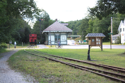
Potter Place Railroad Station, where we joined the trail after leaving home on the bikes. This ride was 12.54 miles (20 km). You can see these photos placed on the
Google map above. Each of the blue markers on the red trail is one of these photos. A complete set of photos of Potter Place and its history can be found
here and
here. We took this ride on August 8. I have procrastinated posting this because of the length, details, and the problems I have had using a mouse on Google maps. But now it works!
 Above
Above: the first railroad bridge we encountered (over the Blackwater River)
 Above
Above: a view of the Blackwater River from the Keniston Covered Bridge
 Above
Above: An original railroad marker. They are spaced regularly along the trail. I never stopped to see what they said (what a mistake!).
 Above
Above: the Lawrence Street culvert tunnel


 Above
Above:
This project was completed by Peter N. Petras Cleopa, Eagle Scout, with friends & fellow scouts of Troop 489.
We dedicate this stairway in memory of James LaFiosca.
Laconia Citizen
Laconia, NH
9 February 2001
James Lafiosca
ANDOVER — James "Jimmy" Lafiosca, 74, of East Andover, died Feb. 7, 2001, in Franklin Regional Hospital.
Born in Brooklyn, N.Y., on Feb. 2, 1927, he was the son of Daniel and Concettina Lafiosca. In 1957, he moved to New Hampshire. He moved to Andover in 1959.
In 1945, he graduated from Brooklyn Technical High School.
He served in the US Navy aboard a destroyer in the North Atlantic.
Mr. Lafiosca and his wife operated an inn in Franconia for two years. Since 1959, he and his wife operated Orchard House, a real estate business, in Andover.
He was past master of Kearsage Masonic Lodge and a member of the York Rite bodies (32nd degree Freemason).
Mr. Lafiosca was an 18-year member of the Franklin Regional Hospital Board of Trustees, serving as president and clerk. In addition, he served as a commissioner of East Andover Fire Department and past president of Andover Lions Club.
He enjoyed woodworking and metalwork.
 Above
Above: Blackwater Park, Howard George Ballfield
 Above
Above: We almost stopped at
our favorite (and only) pizza place — they put a spur on the trail for bikers.
 Above
Above: old railroad bridge over the Blackwater River
Wingnut on his bike; my bike leaning on the bridge.
 Above
Above: a geodetic marker at the bridge above.

 Above
Above: the trail goes underneath Route 4 in Salisbury
 Above
Above: Horseshoe Pond
A causeway was built for the railroad that cut this pond in two.
 Above
Above: The Andover Town Garage
 Above
Above: Wetlands are near the end of this section of the rail trail, near Plains Rd, East Andover.
Technorati Tags: Blackwater River Northern Rail Trail Potter Place Keniston Bridge Mount Kearsarge Del.icio.us Tags: Blackwater River Northern Rail Trail Potter Place Keniston Bridge Mount Kearsarge Flickr Tags: Blackwater River Northern Rail Trail Potter Place Keniston Bridge Mount Kearsarge Furl Tags: Blackwater River Northern Rail Trail Potter Place Keniston Bridge Mount Kearsarge _/\_/\_
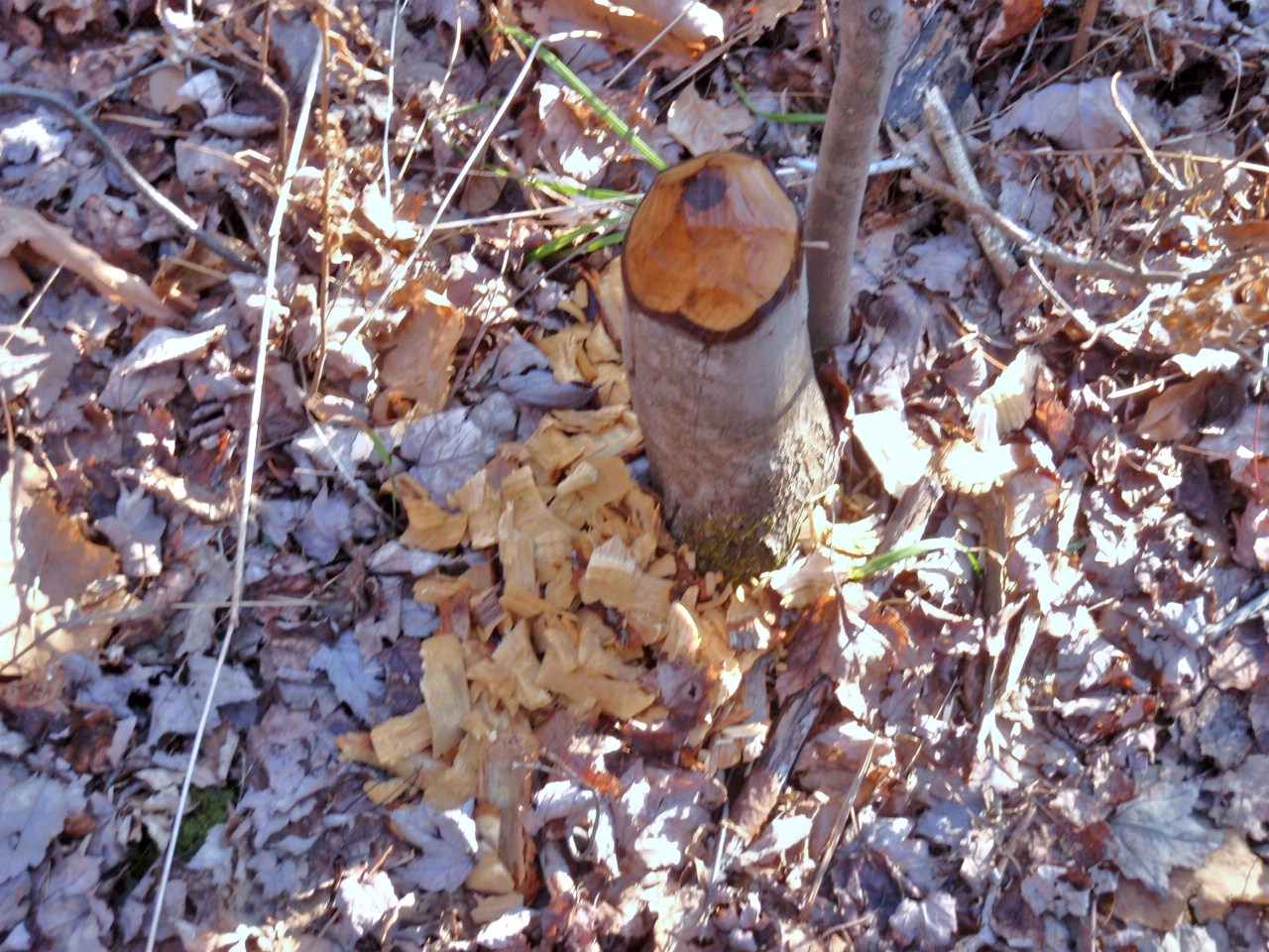
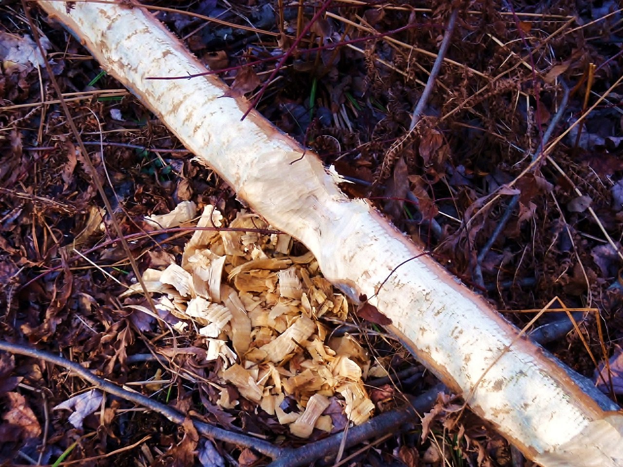 We took a walk, in late fall, along the Blackwater River across the road. Close to home we found amazing evidence of beaver activity. The quantity of wood cut and of beaver sign was just great. The first three photos are of trees that the beaver had cut, trimmed and abandoned for the time being.
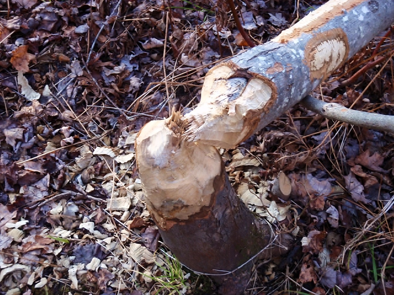
 Below is a photograph of something of which I had no previous knowledge: beaver and/or muskrat escape holes. Among the wood debris the beaver had left behind in the woods was this hole in the ground. There was water in the bottom of the hole. Beavers or muskrats use holes like this if they are caught on land. They can jump down the hole and escape to the river even though it is quite a distance away.
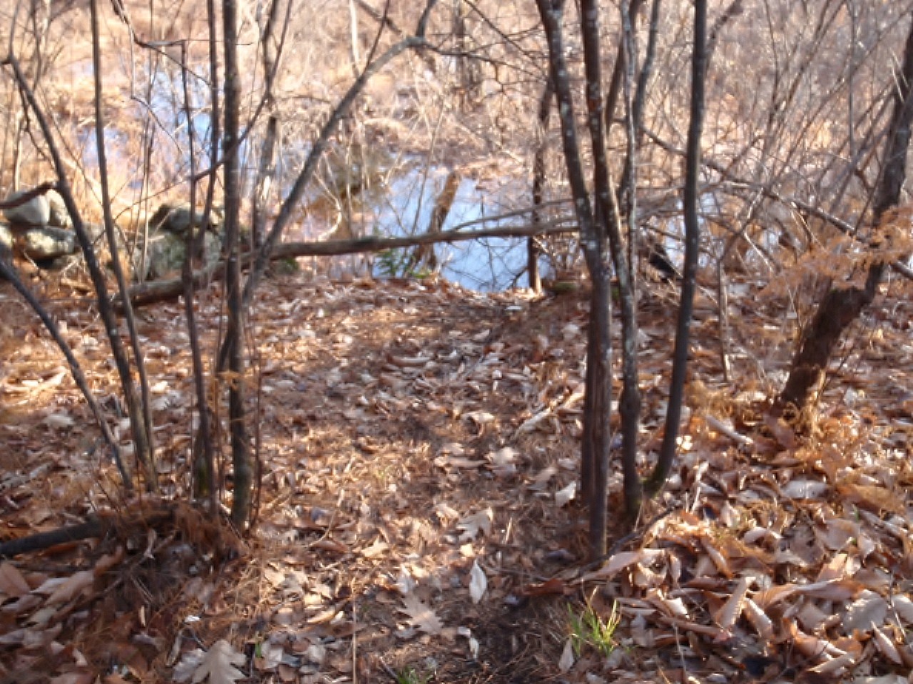
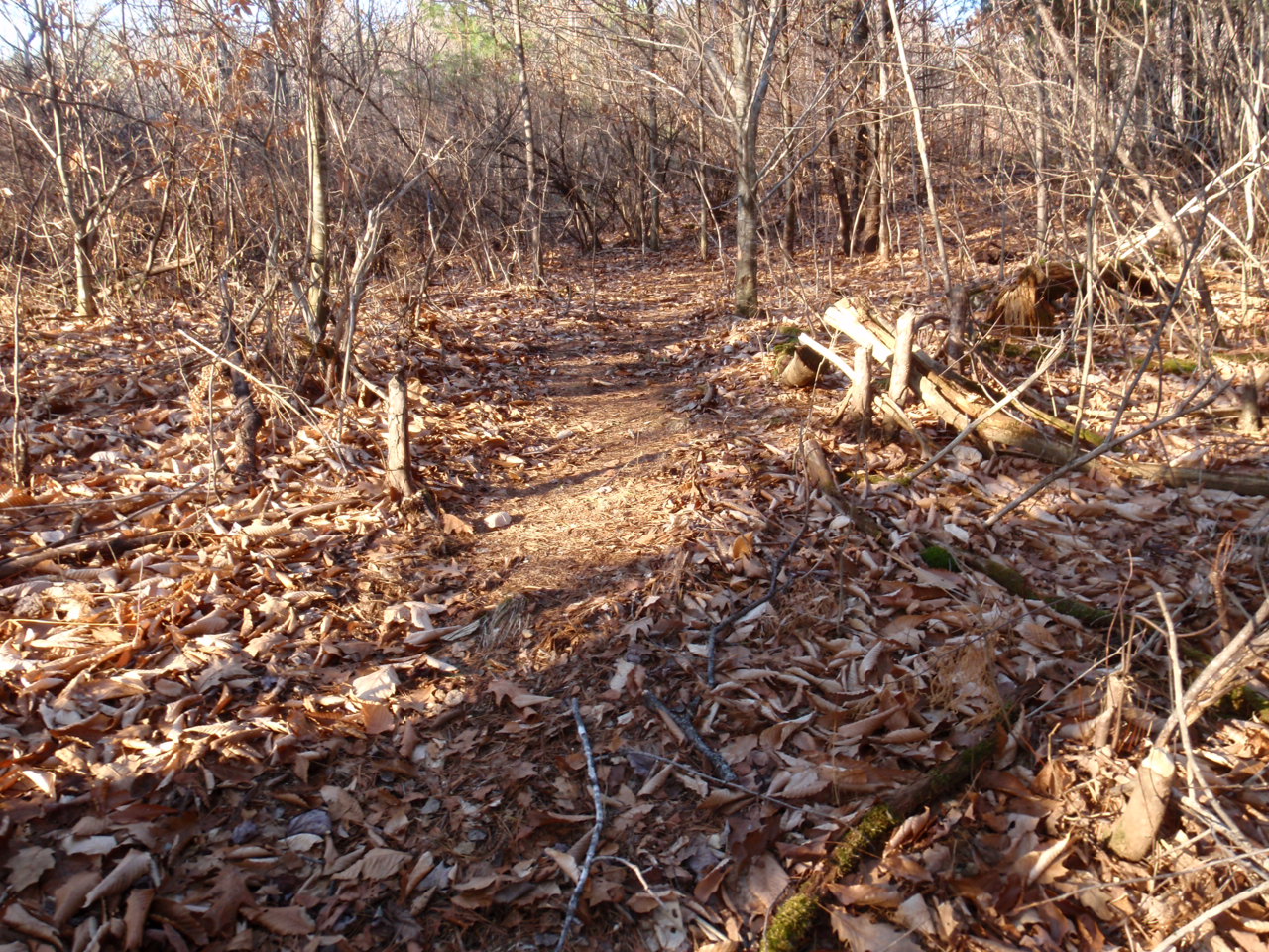 In the photo above, you see what appears to be a road. My back is to the river here. I pivoted and took the photograph below, where the road ends in a slide into the river. This is a beaver road that they use to drag their trees and limbs to the river and then float them to their dam. I saw the huge dam they had built but I couldn't photograph it well enough to illustrate it here. At some point I know we will return and perhaps I'll get a good shot then.