Showing posts with label Vermont history. Show all posts

Thursday, August 14, 2008

The Honorable Timothy Hinman

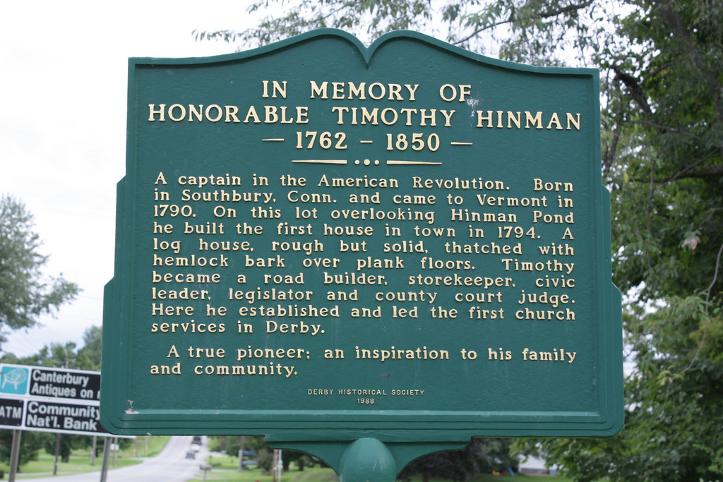
seen on Rt 5 near Derby Pond Veterinary Clinic

IN MEMORY OF HONORABLE TIMOTHY HINMAN

— 1762 - 1850 —

A captain in the American Revolution. Born in Southbury, Conn. and came to Vermont in 1790. On this lot overlooking Hinman Pond he built the first house in town in 1794. A log house, rough but solid, thatched with hemlock bark over plank floors. Timothy became a road builder, storekeeper, civic leader, legislator and county court judge. Here he established and led the first church services in Derby.

A true pioneer; an inspiration to his family and community.

Derby Historical Society
1988

from The Vermont Historical Society Community History Project:
Timothy Hinman was the man who built the Hinman Settler Road in the late 1700's. His road played a big part in the colonization of much of northern Vermont. It was also used in the Civil War by traders bringing supplies to men fighting in the war. Other than building the road, Hinman was a teacher, farmer, and a shop keeper. He had a wife and eleven children. He really was a great man.
  • Timothy Hinman was the first permanent settler in Derby.
  • Timothy was born in Woodbury, Connecticut. Woodbury is currently named Southbury.
  • His parents were so religious they baptized him the day he was born.
  • Timothy's ancestor, Edward Hinman, guarded King Charles 1 of England.
  • Timothy married his wife Phebe Stoddard on December 10, 1786.
  • Timothy's wife Phebe died in 1858, eight years after her husband did.
Click the Historical Society link above for more information on the Hinman Settler Road.

Technorati Tags:
_/\_/\_

Monday, August 11, 2008

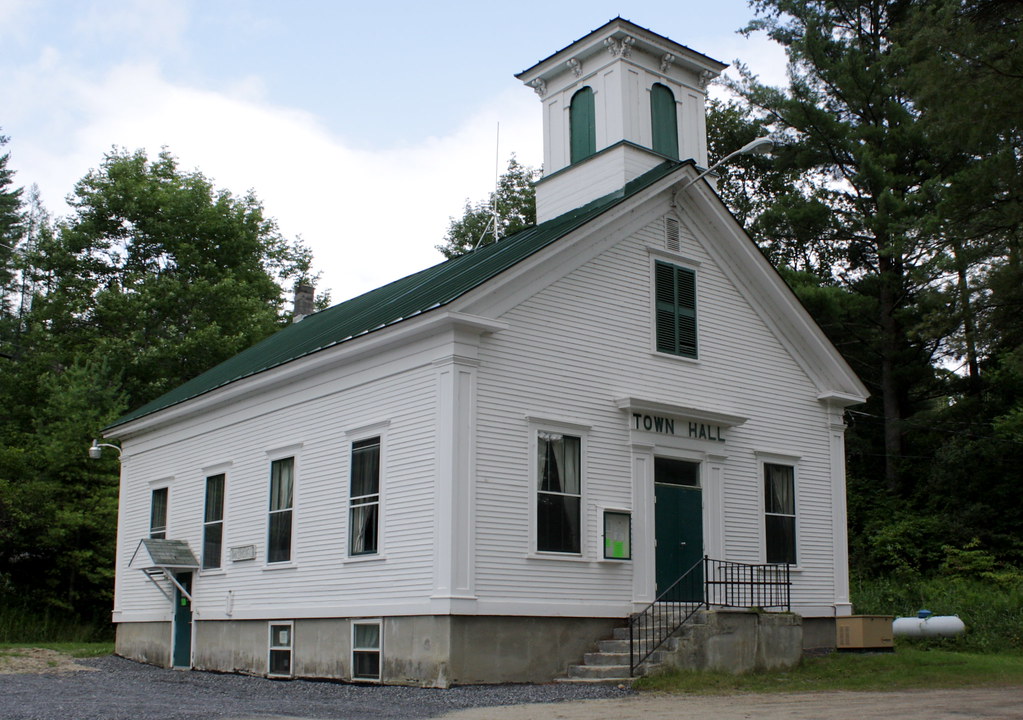
Wheelock, Vermont

This is the Wheelock, Vermont town hall. My sister had her wedding here on February 10, 2001. I lived in Connecticut then and I couldn't get here because the weather was so awful all over New England that I had to turn back in Massachusetts. I told her to never get married in February again!

Last week I drove by this town hall twice a day on my way back and forth to the class "Teaching Mathematics to ADD/ADHD/LD Students." It was three intense eight hour days. I learned a lot and got a lot or resources for this coming school year.

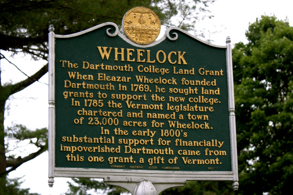
Here is some more information about the founding of Wheelock:

WHEELOCK
The Dartmouth College Land Grant

When Eleazar Wheelock founded Dartmouth in 1769, he sought land grants to support the new college.

In 1785 the Vermont legislature chartered and named a town of 23,000 acres for Wheelock.

In the early 1800s substantial support for financially impoverished Dartmouth came from this one grant, a gift of Vermont.

Technorati Tags:
_/\_/\_

Wednesday, July 30, 2008

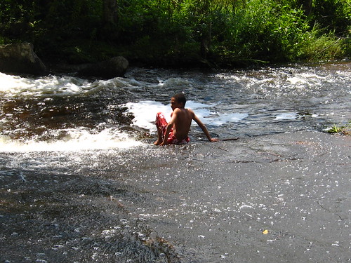
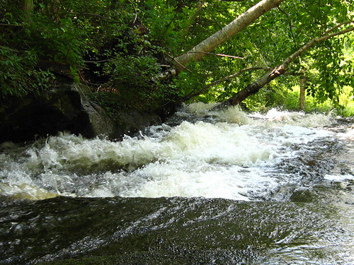
Matt & Wingnut at Stone Flume

Photos by Matt of Wingnut enjoying sliding down the flume across the road on a hot summer day after a hike.

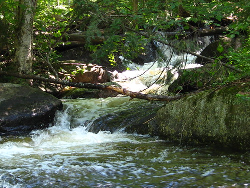
I learned the name of this flume from the Barton Town Map, page 5, found at the Town Clerk office. A gentleman named Barnard used to have a grist mill here. The ruins are still visible.

Above: May Brook as it enters the flume.
Below: May Brook as it starts down the flume.

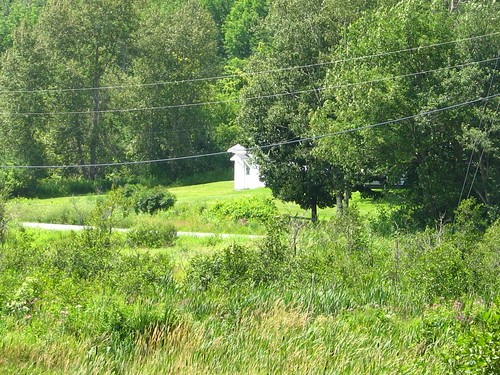
Below: my house as viewed from the flume with zoom lens.


And finally, a video that Matt made of the flume.


Technorati Tags:
_/\_/\_

Saturday, July 19, 2008

Wingnut's Barton Tour

July 6: the temperature in the shade was like 121°F (50°C) yet Wingnut took the wagon tour of Barton to see how the village has changed over the last century and a half. I stayed at the Crystal Lake Falls Historical Association Barton Museum of Education and Manufacturing. I chatted with Dottie, had lemonade, and took some photos in the museum (with permission).

Cherry Tree Hill Yarn's horses pulled the wagon. They took about 12 people. You can see Wingnut below in the wagon. See the lady next to him with the Boston Red Sox cap? She is 94 years old and although she was not in charge of the tour, she essentially provided all the narration because of her superb memory.

I will be writing two more posts on the Barton granite quarries on Barton mountain based on information I found at the museum. I do not include the information here because it is a long post.

The museum is in the Pierce House, which I photographed in the winter as part of my historic buildings assigment. The museum is always collecting pieces, so if you know of any Barton artifacts, please consider contributing.

A machine from the 1800s used to make baseball bats.
This business was an important part of Barton manufacturing.

Cash register and fireproof record keeper used in the blacksmith shop of Thomas Redington from 1910 through 1938. From then on it was used in his service station until his retirement in 1964 at the age of 82.

An intact 1915 calendar.

A rocking butter churn.

Wingnut survived the heat! He was not scared of falling out of the wagon (which I tend to fear on sleigh rides), and the heat did not bother him. But he has little memory of the historical narration. What 12 year old boy would?

Technorati Tags:
_/\_/\_

Saturday, July 05, 2008

Orleans County Quests: Barton Brick

On Tuesday, July 1, Wingnut and I did our first Orleans County quest here in Barton. I am reproducing the text of the quest with Wingnut's photos. Vermont fourth graders study Vermont and local history. These quests were part of a county-wide project two years ago and published by the Stone House Museum.

Solid Rock Assembly of God Church, Barton
(formerly the United Methodist Church)

Built in Eighteen Eighty-Seven,
This "solid rock" points straight to heaven.
But, in '47, fire and flame,
Persuaded the Methodists to change its name.


Look at the church, then look to your right.
Your next destination will be in your sight.

Barton Public Library

The library was built in the twenty-seventh year,
Stories inside go from ear to ear.
This little brick building brings joy to our town,
When someone walks in, their frown turns upside down!

Historical marker in front of the library

If you follow your nose to the Chinese place,
Take your time and do not race.

Ming's House Chinese Restaurant

In the distance on your right,
The Memorial Building will be in sight.

Barton Memorial Building

This brick building, a small idea in 1923,
Became a big memorial to honor the military.
In 1929, the Seaver Block burned down.
In 1930, this was built here for the grateful town.

Gazebo on the village common

Across from the Common, our island in the street,
Look for another brick building where bankers like to meet.

Veteran's Memorial on the village common

The Bank Block

Behind the building the roalroad rides.
It was built in 1905.
if you were born in 1923,
A millionaire it could help you be.

Railroad Overpass

Go past the place where you'd mail a bill.
Turn right at School Street and head back downhill.

Barton Post Office

Look to your left and walk to your goal:
A four story building with a big flagpole.

Flagpole at Barton Academy & Graded School

In 1907 this Academy was built,
Of brick and grante — look up — does it tilt?
After sixty-nine years, the town gave permission,
For a cafeteria and gym as a needed addition.

No treasure box under the tree!

The end of the quest: a missing treasure box! We are going to notify the Quest project people about the missing box.

Musk mallow growing in the C & C parking lot.

Technorati Tags:

_/\_/\_

Thursday, June 19, 2008

Derby Academy

A sign marking the spot where the Academy (or high school) stood until 1957.
1840 DERBY ACADEMY 1967
THE OLDEST INCORPORATED SCHOOL IN ORLEANS COUNTY

On this site the Derby Literary and Theological Institute — a private boarding school — was founded by the Danville Baptist Association on one acre of land given by Lemuel Richmond and Benjamin Hinman. Colonel Chester Carpenter led a campaign for support as citizens readily came forth with money, labor and their produce to build a secondary school. Donated cattle were driven to a Brighton, Massachusetts market to help raise funds.

Counless numbers of students and this community have lived and prospered under the school motto
Qualis Non Quantus

A 1904 postcard of the Academy:
Jan 6
Dear Sister Mary we rec'd. your pkg. O.K. Many thanks for the jam (?). We are all well and hope this will find you all well. I wish it were s0(?) you could come out here. From your brother Will.
Behind the old Academy bell you can see the parking lot for the North Country Union Junior High School with a bit of the school beyond. You can also see a newer wooden sugarhouse with green roof that is an ice cream stand in the summer.

Presented June 2001
By The Derby Academy Alumni
DERBY ACADEMY BELL
Cast by George H Holbrook in Midway, Mass. in 1841. Moved from the old boarding house about 1869, it hung in the Academy building until the building was replaced by the present Junior High building in 1957.
Photos taken during the week of June 10 during inservice programs for district teachers at the junior high.

Technorati Tags:
_/\_/\_

Sunday, May 25, 2008

Blog Your Blessings: Memorial Day: Dying Alone

Photographed 24 May 2008


CHAS. DEVEREUX
Co. F
11 Vt. Reg't

DIED

at Baltimore, Md.
Nov. 17, 1864
AEd 33 yrs, 4 ms

Charles Devereux was born in some unknown place in 1831. He enlisted in the Vermont Volunteer Infantry on August 6, 1862 in Barton and was mustered in on September 1, 1862 as a Private in Co. F of the 11th Infantry Regiment. He was promoted to Corporal on May 1, 1863. Charles was mortally wounded in action at the Battle of Cedar Creek on October 19, 1864 (with twenty-three other Vermont Volunteers).

The Battle of Cedar Creek was in Middletown, Virginia. Every single Vermont man in service in 1864 fought at the Battle of Cedar Creek. Charles's 11th Vermont Regiment served in the VI Corps of the Army of the Shenandoah commanded by Major General Philip Sheridan. They were in the 2nd Division, 2nd Brigade and were among the first sent into battle. The Army of the Shenandoah had 31,610 men and 90 guns in battle. Five hundred sixty were killed, 3025 were wounded, and 1770 were taken prisoner. The Confederate Army fought with approximately 21,102 men (exact figures are unknown) and 40 guns. Killed and wounded were 1860 people, and 1500 were missing at the end of the battle. All suffered horribly.

Charles died of his wounds in Baltimore, Maryland on November 18, 1864 — hopefully in a hospital. He was buried in Welcome O Brown Cemetery in Barton, Vermont, were I found his grave yesterday. There are no photographs, family, obituaries or memories of Charles anywhere except for his gravestone.
Many casualties, especially during the 1863-1864 campaigns, are probably buried in mass or unmarked graves, and their final resting place will never be known. There are also, in Vermont, many cenotaphs, or empty graves; some of these are not marked as such, but are a fitting memorial to the fallen solider nevertheless.
The Vermont drummer at the Battle of Cedar Creek, Julian Scott (born in Johnson, VT), won the Medal of Honor. He painted The Battle of Cedar Creek, which hangs in the Cedar Creek Room of the Vermont State House in Montpelier. I photographed this painting when I visited in October of 2007.

detail

The Cedar Creek Room of the Vermont State House

References:

To read more blessings click
or Blog Your Blessings

Technorati Tags:
_/\_/\_

Tuesday, March 04, 2008

Heads or Tails: 243: A Map of the Republic of New Netherland << Strange Maps


243 - A Map of the Republic of New Netherland
New Amsterdam never gave way to New York. The Dutch kept the whole of their North American colony out of the hands of the perfidious English, in fact. New Netherland today constitutes a thriving Republic stretching from the Atlantic coast to Québec, dividing New England from the rest of the United States.

This Republik van Nieuw Nederland is the brainchild of Paul Burgess, who’s been fleshing out its allohistorical details since his mid-20s – he’s even devised a pretty cool flag for the Republic, not to mention an anthem (’Onze Patrie’ – ‘Our Fatherland’), names for the baseball teams in the Knickerbocker League, a list of the best places to smuggle goods across the border to the US and even call letters for New Netherland radio stations. And, of course, this map.

Mr. Burgess’ fictional country has its origins in a PoD (Point of Divergence) in the year 1638, when not the irascible Willem Kieft, but the level-headed David Pietersen de Vries is appointed Director-General of the colony. De Vries pushes for colonisation, good relations with the Five Nations tribes, self-government and expansion and consolidation of the borders.

New Netherland achieved independence in 1798, after the ‘old’ Netherlands were overrun by the French. Philip Schuyler, the last Director-General of the colony, became the first Prime Minister of the independent Republic. Influential successors were PMs Maarten van Buren (1820-1856), and the Roosevelts: Theodore (1897-1919), Franklin D. (1930-1945) and Quentin (1948-1965), Theodore’s son.

The Landdag (Parliament) is comprised of the lower House of Burghers and the higher House of Peers.According to the 1980 census, New Netherland measures 71,288 square miles, counts 31,2 million inhabitants and is divided in 13 provinces, one city (New Amsterdam) and one freeport (Philadelphia). Most populous city is the capital, New Amsterdam (7 million). About 85% of the New Netherlanders speak Dutch, 9% English (mainly in Philadelphia, New Haven, Hartford and eastern parts of Vermont and Long Island) and 6% one of the Iroquois languages. READ MORE.
I have no idea how this relates to "Seven" but here 'tis.
I love the map and the history.

To see more Heads or Tails participants, visit Skittles
or click .
Thank you so much for visiting.
_/\_/\_

Sunday, November 11, 2007

Unplugged Project: Red Maple Leaf of Vermont Facts

The concept of the Vermont Leaf of Facts is not mine but the implementation is. Deb Markowitz, the Vermont Secretary of State, published Vermont History: Facts and Fun. Spencer Rothbell made this illustration of a maple leaf of Vermont facts. In the fourth grade, Vermont children learn the history and government of their state. Our fourth grade teacher and computer lab person use this page as a fun way to not only teach about Vermont but to learn Microsoft Word and improve keyboarding and formatting skills. I took the exercise and made a simple jpeg file for today's Unplugged Project. If you click on the graphic, a larger version will open in a new window, making it easier to read. I also curved the stem a bit.

Visit other participants of the Unplugged Project here.
Next week's project is open-ended and the theme is BOX.

_/\_/\_

Sunday, October 07, 2007

Our Last Photowalk


During this photowalk, I again explored the lower beaver dam on May Brook, the century and a half old reservoir, and the old waterworks. Below I quote from Darlene Young's book A History of Barton Vermont:
Barton residents wanted a public water system for a number of compelling reasons. First and foremost, waterworks meant increased fire protection, making it possible to play hydrants throughout the village. Secondly, waterworks would supply an adequate amount of pure water to homes. And thirdly, a system of waterworks was a significant mark of a progressive village. Barton aspired to follow the lead of Newport and St. Johnsbury, which had already installed waterworks.

The talk in favor of a waterworks for Barton began in earnest in 1885. The village had improved its fire protection with a new fire engine and was building a series of cisterns for water storage. But many in the village saw the cisterns as only a temporary solution. The Orleans County Monitor pointed out that a system of waterworks would fill the need for fire protection as well as domestic use.

The trustees called a village meeting to consider the question of waterworks. The voters established a committee to investigate the feasibility and cost of a water system. The committee presented several options for supplying water to the village from Crystal Lake, estimating the cost at around $8,500. But voters rejected the proposal.


For the next few years, discussion of the question continued without any resolution. In 1886, the Legislature authorized the establishment of a system of waterworks for Barton. In 1888, the Legislature amended the water charter to permit the raising of $20,000 in bonds for the construction of the water system. Despite this, Barton voters took no immediate action.

In 1889, the village began looking at other water supplies besides Crystal Lake. Joel Foster of Montpelier, an engineer and veteran waterworks builder, cam to Barton several times to study the possibilities. Foster considered using a number of water sources: Roaring Brook, Parker Pond, and May Pond.

At a special village meeting held in July 1889, the first question put to the voters was a simple resolution. The resolution expressing the need for waterworks passed on a voice vote. The second article, "To see if the village would vote to erect a system of waterworks," brought a lengthy discussion. Foster explained the different routes and methods of bringing the water to the village. He estimated the cost at approximately $17,000. When debate ended, the voters, by a margin of 70 to 42, decided to use May Pond as their water source. They also approved a bond for $16,000.

Work began almost at once. Workmen built a stone dam at the reservoir, dug ditches, and laid the cast iron pipe to homes and businesses during the fall of 1889. Just before winter set in the village completed the mains and water began to flow.
If you wish, you can see the photos in my web gallery here, or in my Flickr set here.

Technorati tags:

_/\_/\_

Calvin Coolidge and Plymouth Notch, Vermont


On September 23, I went to the Calvin Coolidge Homestead in Plymouth Notch, Vermont. Coolidge was the 30th president. You can find visitor information here. There was a Cheese and Harvest Festival going on, so it was crowded but fun. I posted a slideshow of the photos here. If you wish to view the individual photos and read the detailed comments, go to my web album here or to my Flickr set here.

I must return as soon as I can to view the cemetary and the Coolidge gravesite.

Technorati tags:

_/\_/\_

Tuesday, September 11, 2007

Worldless Wednesday: The Second Vermont Republic at The Bread & Puppet

A giant puppet promoting the establishment of the
Second Vermont Republic at the Bread & Puppet Museum


All text is from Wikipedia:
Vermont Republic:
"The Vermont Republic was a North American independent republic founded in 1777 and continuing until 1791, when it became Vermont – the fourteenth state of the United States."

Second Vermont Republic:
"Second Vermont Republic (SVR) is a secessionist movement within the U.S. state of Vermont to return the independent status of the Vermont Republic from 1777–91."

Bread and Puppet Theater:
"The Bread and Puppet Theater (often known simply as Bread & Puppet) is a politically radical puppet theater, active since the 1960s, currently based in Glover, Vermont."

Technorati tags: , , ,
_/\_/\_

Tuesday, August 14, 2007

The Barton Fair: Create Personalized Google Maps


Google Street Map - map-generator.net
This is an interactive, clickable, zoomable map of the Orleans County Fairgrounds in Barton, Vermont. The fair, usually called the Barton Fair, opens tomorrow and goes through Sunday. My favorite parts of the fair are the poultry exhibits and the demolition derby. (Yes, I want chickens!)

The fair has a notorious history. You can read about it in this lengthy but excellent article that I found that gives you the flavor of my area. Edward Hoagland wrote in the article "Natural light: Life among Vermont's hippies, hunters, bears, and moose" about his life in Barton for Harper's Magazine in October 2000 that :
In Barton we had a wild, cruel county fair with (deleted) girlie shows--$3 for (deleted) – famous among carnie types as far south as Alabama, that the Quebecois poured across the border by the thousands to see.
In her book A History of Barton, Vermont, Darlene Young writes that the Vermont attorney general's office "concluded that the shows at the Orleans County Fair were 'the roughest of any in the state' and included illegal activities." She continues:
The fair did eventually eliminate the "girlie shows" [in the last half of the 1970s] from its attractions, but it was only partially in response to the public outcry. When Canadian spectators decreased, the fair directors lost their main justification for the "girlie shows": the shows simply weren't making as much money.

By that time, the fair had discovered a new moneymaker. In 1975, the Orleans County Fair hosted its first demolition derby.
+ + + + + + + + + +

I am experimenting tonight with an embedded Google map of the location of the fairgrounds (about 3 miles from my house). I read in Create Personalized Google Maps: "The Google Operating System Blog" (it is not an official Google blog) that Google announced today that next week embedded maps will be available for blogs. You will be able to embed an interactive map just like you embed a YouTube video. That will be great because right now you have to jump through hoops to get a map here on Blogger. (See the Google Earth Challenge posts to see what many of us have done).

At this time, according to another post on this blog, Embedding Google Maps, you have two methods to embed a map in your blog post. I tried them both. Both are free.

Map Generator is the easiest to use if you know the exact address of the location you want to map (often very difficult in this area). After I found the address of the fairgrounds on Google Maps and put that address into Map Generator, it was a snap to get the code to embed my map here. However, I had to alter the code for the embedded map so that it would fit within the middle blog column. If you are not willing to do that, you could end up with a very messy blog. My Maps Plus was very difficult for me to use. I did not like the map it created at all.

However, if you can wait until Google makes embedded maps available, you won't need to use either of these sites. Have fun with your maps! Watch the Google Earth Blog and Google LatLong Blog for announcements.

If you are able, come to the fair. It's clean and fun!

Technorati tags:

_/\_/\_

Sunday, August 05, 2007

Counting On Grace by Elizabeth Winthrop

Summer Read-Alouds

Wingnut and I read one or more books outloud at bedtime every summer. This year we read Counting on Grace by Elizabeth Winthrop. I chose this book because it was the Vermont Reads 2007 selection of the Vermont Humanities Council. The Barton Public Library handed out copies of this book to anyone that cared to read it. I picked up our copy months ago when I attended the library movie night in May. Vermont Public Radio broadcast readings of the entire book earlier in the year, which I missed (there is an audio CD available). However, on September 29 there will be a VPR Vermont Reads Day focused on this book.

Counting On Grace is the story of a 12 year old French Canadian girl who lives with her poverty striken family in Vermont in the early twentieth century. The entire family works at a fabric mill and as each child reaches the age of 14 they are expected to work in the mill to help support the family. However, corrupt enforcement of the weak child labor laws enabled children much younger to work in dangerous, life-threatening conditions. Winthrop (click on this link to read her blog) uses this family to detail not only the conditions in which these children lived but also the remedy. Winthrop introduces us to the photographer Lewis Hine, whose photography helped reform the child labor laws in the United States.

This is an excellent book. I was concerned that the story would not keep the interest of an 11 year old boy but there was enough action, injustice and gore to keep him asking for more. The gore in the book is entirely appropriate and is needed to document the conditions under which these people worked and lived. As you know, Wingnut has become an excellent photographer, so the descriptions of ancient photography methods fascinated him.

I expected Counting On Grace to be another bland look at life one hundred years ago. I'm glad I was wrong. There are dozens of topics a teacher can integrate throughout this book in language arts, science, history, technology and mathematics. I am always very careful and skeptical of integrating mathematics with literature because the mathematics curriculum topics in literature usually are not rigorous enough or are below grade level standards and expectations. I think this is probably because of most authors' fear and/or lack of knowledge of mathematics. But Elizabeth Winthrop doesn't flinch. Careful planning and integration with the mathematics curriculum can enhance and expand the understanding of the conditions described in Counting On Grace.

Now if only I could get Wingnut back for the VPR Vermont Reads Day.

Remember: if you buy this book now by clicking on the book image or on the title, I will get paid. Then I can buy my Canon Rebel XTi (and give my little Kodak Z710 point-and-shoot to Wingnut).

Technorati tags: , , , ,

_/\_/\_